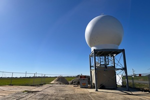
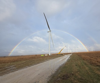
 The Fraunhofer Institute for Wind Energy Systems (IWES) has begun operating a new Dual Doppler wind radar system near the DLR research wind farm WiValdi in Stade, Lower Saxony. This system enables high-resolution, three-dimensional wind field measurements over a wide area and could support more efficient wind farm planning and operation.
Developed by SmartWind Technologies (USA), the radar was installed as part of the German-funded “Wind farm RADAR” project. Fraunhofer IWES is conducting scientific validation in partnership with ForWind at the University of Oldenburg. The aim is to make the radar data service available to the wind sector, providing valuable input for site assessment, performance monitoring and turbine layout optimisation.
The system covers an area exceeding 1,000 square kilometres and collects wind data every two minutes, measuring at distances of up to 35 kilometres and capturing wind behaviour across the entire rotor area and into the lower atmosphere. It provides real-time data on wind direction, turbulence, wake effects and load distribution, helping to reduce investment risk and improve turbine performance estimates.
The technology operates by using two radar units with four-metre dishes that emit electromagnetic pulses. The radar detects reflected signals from airborne particles, allowing precise wind speed calculations in three dimensions. Additional equipment on site includes lidar instruments and rain sensors to cross-check data accuracy.
The system began continuous operation in June 2025, and an offshore campaign is planned in England later. Fraunhofer IWES will eventually offer the radar as a full-service measurement solution for wind farm planners and operators, including equipment deployment, data analysis, and validation.
Image courtesy Fraunhofer-IWES-Jan-Diettrich


