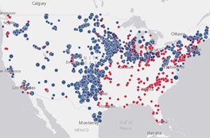
 Using a new map tool released anyone can now easily view the location of every utility-scale wind project and wind-related manufacturing facility in the USA. The American Wind Energy Association (AWEA) released the map to help people visualise the growth of America’s largest source of renewable energy capacity.
A time-lapse feature built into the map shows the progress of wind power development across the country. Starting from 1981 in the passes of California where the first modern wind energy projects were completed, users can see the story of American wind power unfold across heartland states like Texas, Iowa, Oklahoma and Kansas, and eventually to the first U.S. offshore wind project completed off Rhode Island in 2016. The map also features markers for the more than 500 wind-related manufacturing facilities in the U.S. today. These factories support 25,000 U.S. manufacturing jobs across 41 states.
